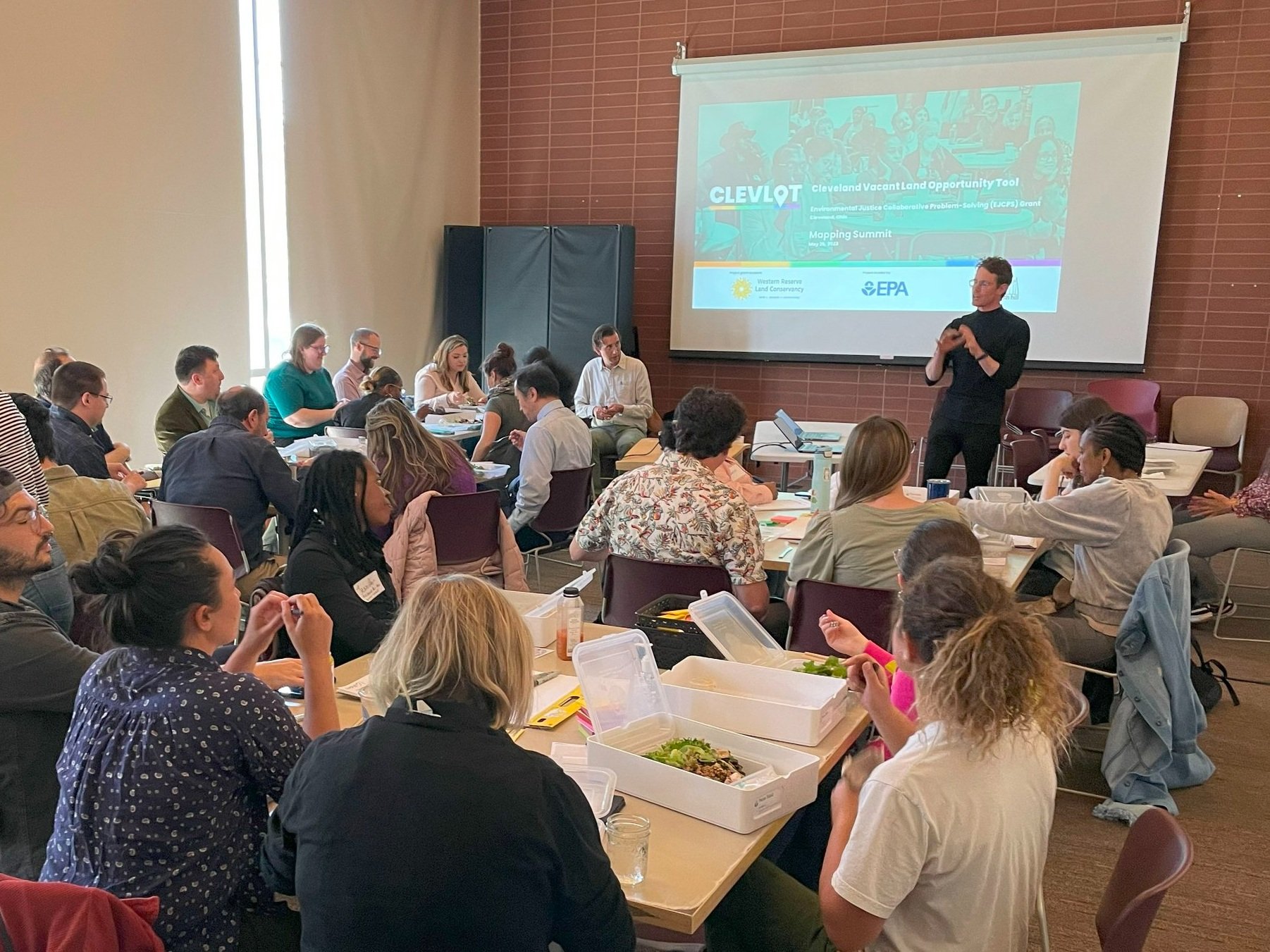
Over 40 CLEVLOT stakeholders gathered at the Cleveland Public Library’s Harvey Rice Branch for an interactive Mapping Summit on May 26th, 2023. The session provided an engaging atmosphere for representatives from the City of Cleveland and other CLEVLOT stakeholders to explore criteria to prioritize vacant land reuse together.
Agenda:
Introduction / review of CLEVLOT
Presentation from Integrated Development Cluster GIS team about work completed to prioritize vacant land reuse
Break out groups to develop additional data layers / criteria GIS team can integrate into map
Open comment session to provide feedback on each group's work
Wrap up and Next Steps
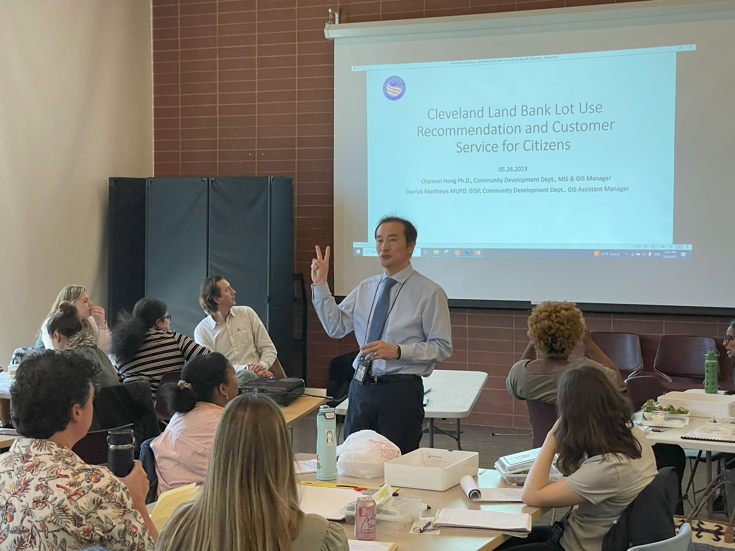
While enjoying a zero-waste lunch provided by Harvest Owl, attendees received updates on key initiatives related to vacant land reuse. Tim Dehm (Western Reserve Land Conservancy) presented recent developments from various tracks within the CLEVLOT process. Matt Moss, Chansun Hong, and Darrick Matthews from the City of Cleveland shared insights from their Integrated Development Cluster GIS team. Their presentations included useful information on the City’s efforts to locate neighborhood amenities within walkable distances and upcoming launch of an online Cleveland Land Bank application portal. All of these efforts are closely integrated with the goal of CLEVLOT to “build healthy and resilient Cleveland neighborhoods through vacant land reuse.”
Presentation slides from the session are shown below:
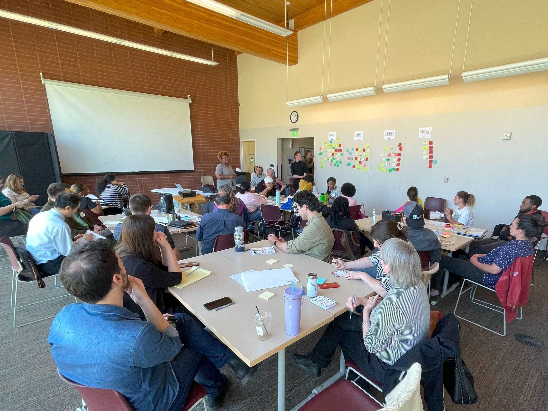
Following the background presentations, the session moved on to more interactive exercises. Attendees were encouraged to think about what nearby amenities enable vacant lot projects to become successful. A bus stop? A fire hydrant? An apartment building? An urban farm?
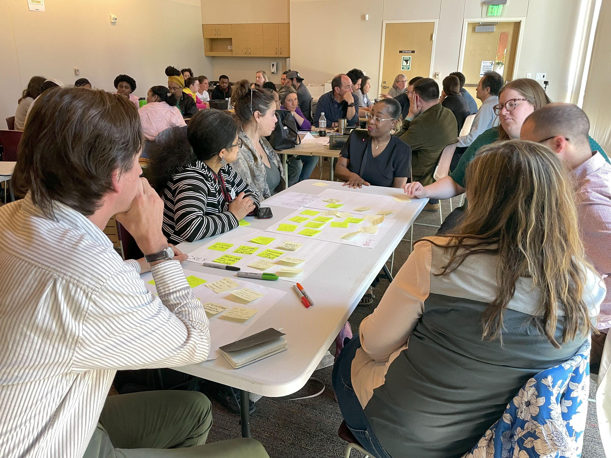
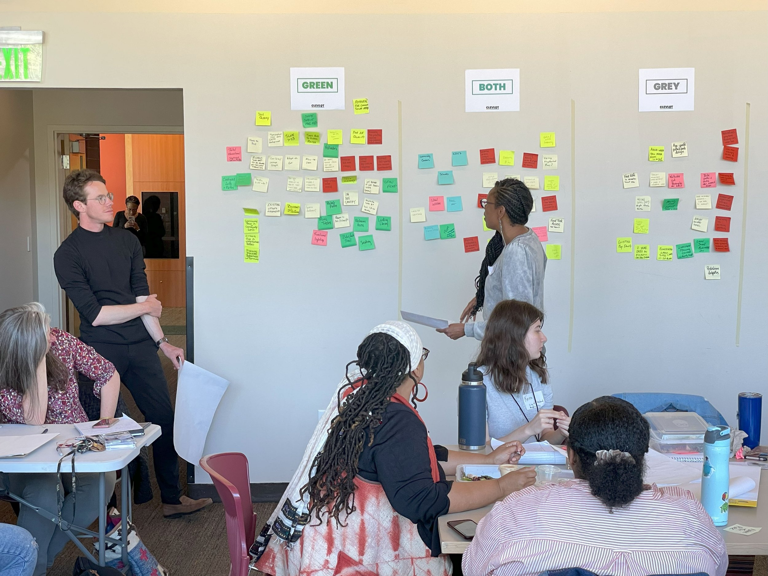
Working in small groups at each table, CLEVLOT members discussed their ideas for vacant land mapping criteria. After about 30 minutes, representatives from each group organized their team’s ideas on the wall under four themes: Green, Grey, Both, and Other.


Once all of the post-it notes were added and sorted on the wall, a spokesperson from each group stood up and shared the most important criteria and questions they unearthed during their conversations. The ideas shared revealed similarities between groups, but also expressed some of the significant challenges that emerge from trying to define common criteria to prioritize uses for vacant land.
After the Mapping Summit, the participant post-it notes were transcribed to an online Miro board. In addition to showing the comments in the original four themes, the Miro board also presents the criteria organized into five different categories:
Environmental Conditions
Parcel Condition
Neighborhood Amenities
Process-oriented
Demographics
Each of these categories also have subcategories, which visually illustrate how vacant land criteria could be combined in various ways.
View the online Miro board below:
By engaging a wide range of stakeholders in the process of identifying criteria for vacant land reuse, we can help ensure the land bank is aligned with the needs of the community. Criteria identified and organized from the Mapping Summit will serve an important purpose. Ultimately, we can map this information to make better decisions about where to locate vacant lot projects, saving valuable time and resources.